Taipei’s Da’an district is one of the most densely populated areas in the world, with over 70,000 people per square mile. Da’an district also includes Da’an Forest Park, National Taiwan University, and unpopulated areas to the south and south-east of NTU. The areas shown here are probably over 100,000 people per square mile.
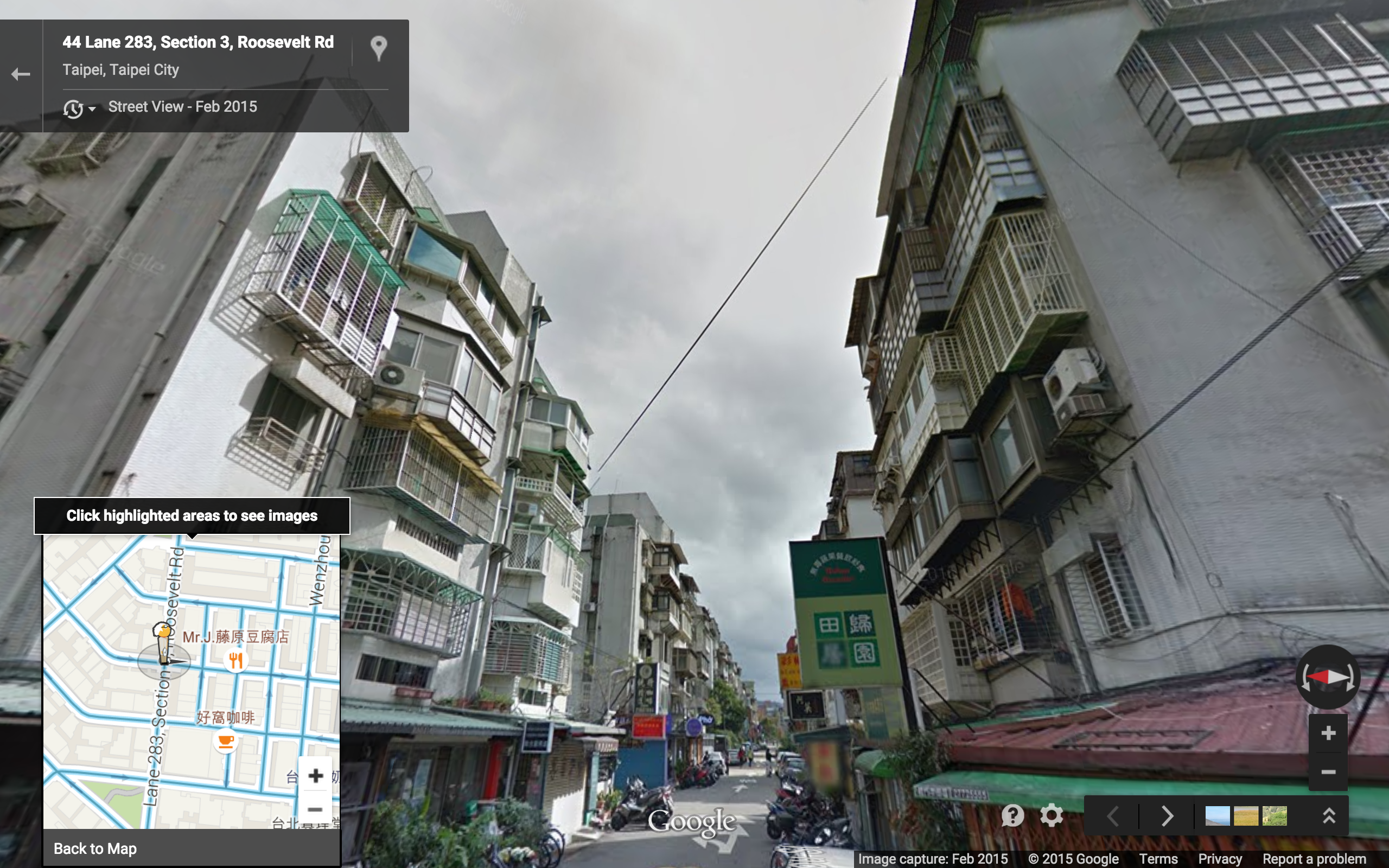
Standing at the intersection where lanes 56 and 58 meet at Wenzhou street, and looking east down Lane 56, we see 6 1/2 story apartment buildings lined up along a narrow mixed modality street. The north-south street at this intersection appears to carry only car and motorcycle traffic.

Surprisingly, at the 50 foot scale, we see only two cafes (and an eatery, obscured by the legend):

Versus an incredible 16 restaurants and coffee shops near Lane 74, just a little to the south-east:

The overall appearance of this second neighborhood is very similar, but with slightly more variation in building heights. The corner buildings appear to be 5, 5 1/2, 6 1/2, and 7 1/2 stories at the intersection of Lane 74 and Lane 283, Roosevelt Road:
The relatively low density of commerce at the first location can be explained by its extreme proximity to the second (and similar proximity to commerce to the east):
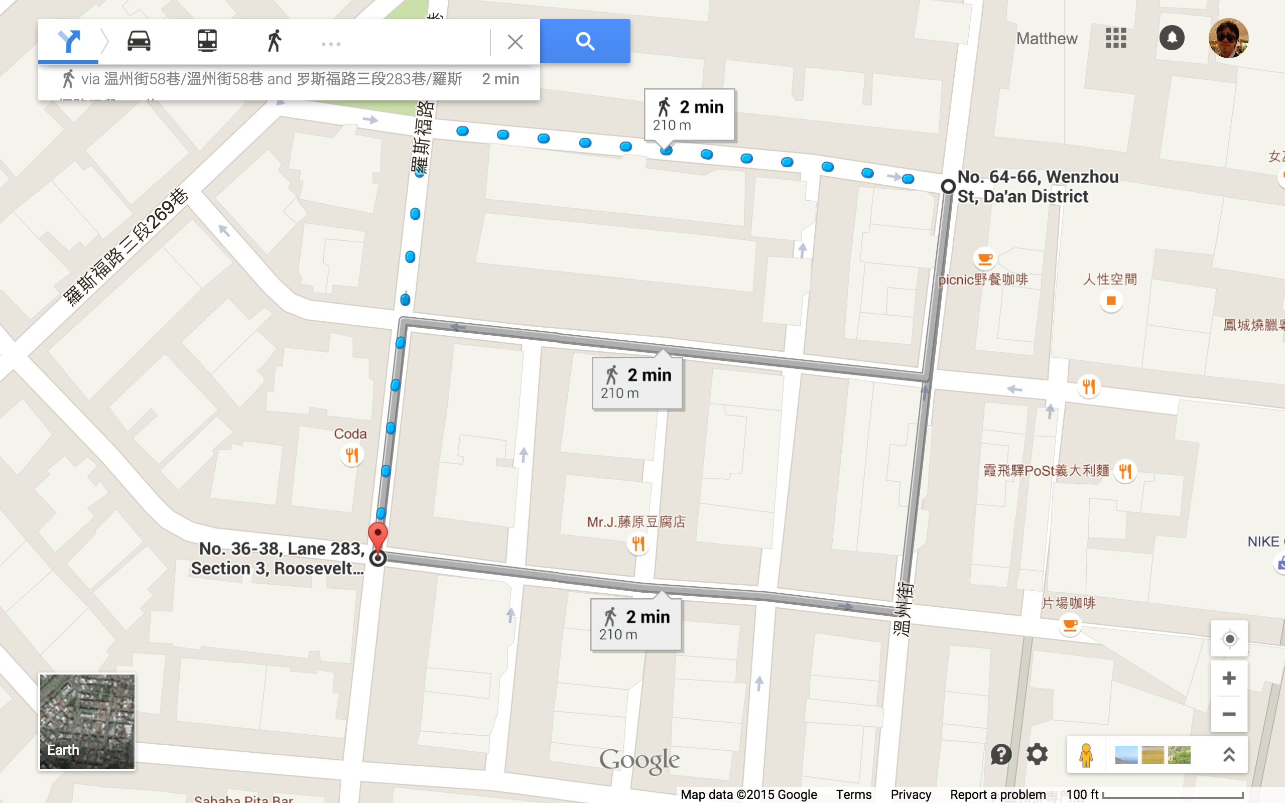
Note that at the 100 foot scale, the vast majority of establishments don’t show up on Google Maps.
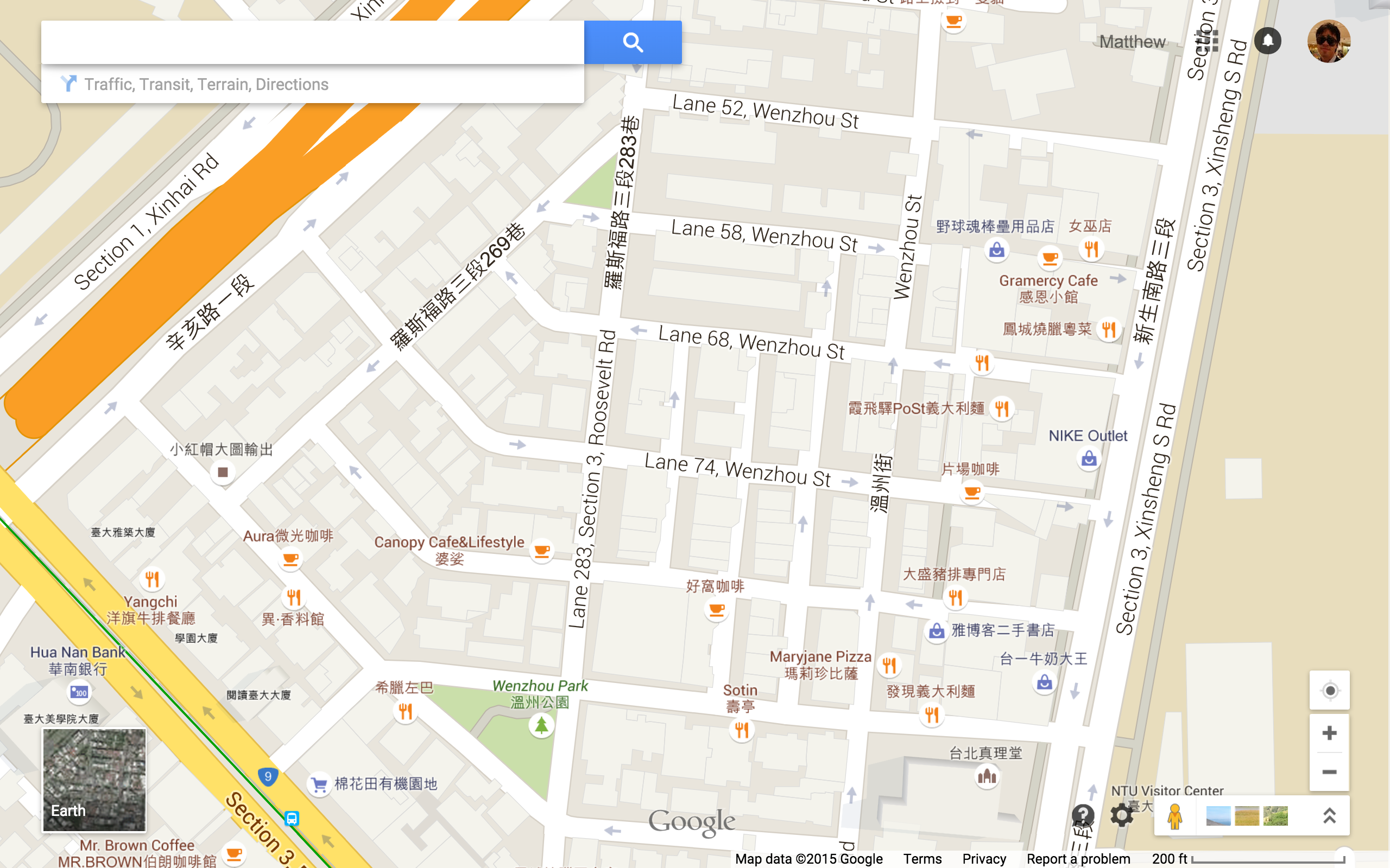
For context, here is the 200 foot scale, with NTU on the east side:
Stats
Area :: Short Block Index
Lane 56 :: 12
Lane 74 :: 15
Together :: 10 (zooming out to the 100 foot scale to include both neighborhoods)
Broader neighborhood :: 4 (zooming out to 200 foot scale includes some larger streets and part of NTU’s campus, both of which contribute very few intersections) I think this low number accurately reflects the lack of commercial vibrancy you see on the east face of Xinsheng Road and north face of Xinhai Road. And of course, these wide roads themselves take up a lot of space too.
