
- Green: covered arcades.
- Orange: slow street (curves have been deliberately added to street to slow traffic).
- Blue: underground halls and malls attached to subway stations.
Stats:
- Length: 5,450′(from north end of arcade to south end of highlighted slow street).
- Spans roughly 1/2 the total width of Kobe (from the mountains to the sea).
- Change in elevation: 60′.
The arcades running from Shinkaichi 3-chome to the Shin-Minato canal in Higashiyama-cho have a very unusual feature; most arcades are fairly flat (they follow contour streets), but these arcades run uphill (roughly orthogonal to the contour lines). #等高線vs勾配線
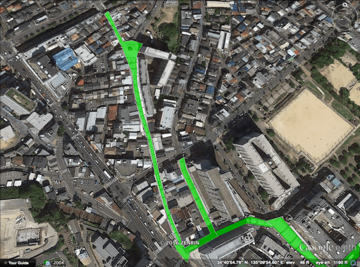
Starting from the uphill-side with Higashiyama Arcade (東山 商店街):
This aerial view shows the Higashiyama and Minaichi (東山・ミナイチ) arcades in green:
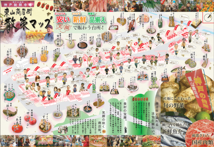
The Higashiyama Shopping Street Promotion Association has an amazingly detailed and extremely well organized map of the interior:
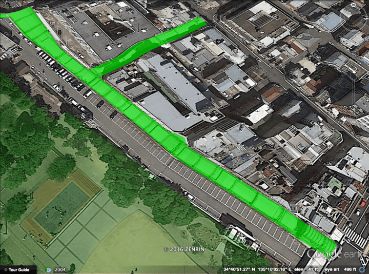
Continuing downhill to Minatogawa Arcade (湊川 商店街):
This aerial view shows the Minatogawa (湊川) arcade in green:
The Higashiyama / Minaichi / Minatogawa arcades constitute the Shinsen-ichiba (新鮮市場), the “Kitchen of Kobe”. Together they host about 500 shops. A clickable map with multiple levels of detail can be found here.
“神戸市営地下鉄西神山手線・湊川公園駅から地上に出れば、そこが湊川一帯に広がる『神戸新鮮市場』の南口です。北へ向かう約1kmの間に、衣食住すべてがそろう約500の店舗がぎっしり立ち並んでいます” ~Minatogawa Shopping Street Promotion Association
Continuing past the park to Shinkaichi Shopping Street’s “Arcade Street” (アーケード街):
And crossing the boulevard to Shinkaichi’s “Sky Gate” (スカイゲート):
And ending on the downhill-side at Shinkaichi’s Mall Street (モール街):
This aerial view shows the Shinkaichi arcades (新開地 アーケード街・スカイゲート) in green, and Shinkaichi Mall Street (新開地 モール街) in orange:

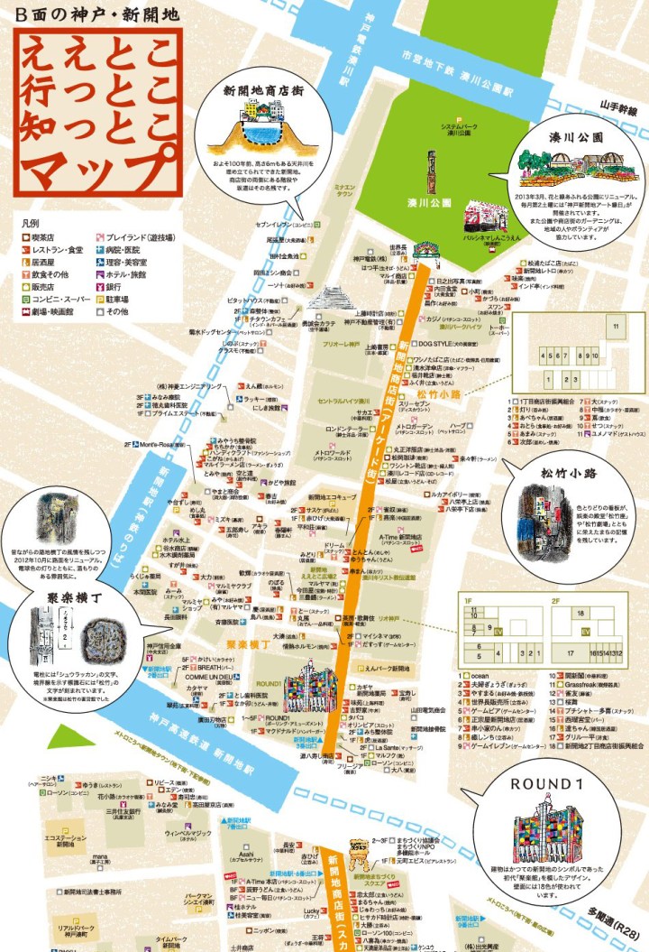
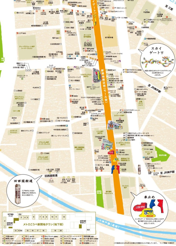
The Shinkaichi Town Management Organization has a most excellent map of the whole area (Arcade Street, Sky Gate, and Mall Street):
One can walk from Harborland (by the sea) all the way to Tachigahata Dam (up in the mountains) in 2.3 miles, spending about half the journey in the arcades and on Shinkaichi Mall Street:
