
Stock photos and televised clips of Shibuya usually depict only the iconic scramble intersection, but there is a lot more to this central Tokyo neighborhood.
In fact, in Shibuya’s liveliest commercial districts, you never have to wait to cross the street (these are the “Nightlife Alleys” described in The Hierarchy of Japanese Streets).
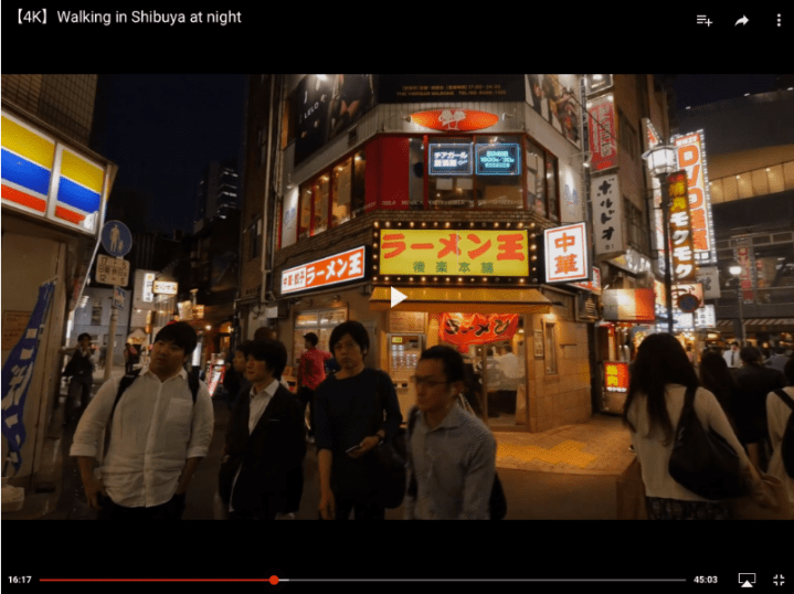
The following screenshots from Walking in Shibuya at night by Rambalac reveal a true pedestrian paradise.
The first 5 minutes are spent strolling about in the station plaza, waiting at the scramble intersection, and enjoying some live music.
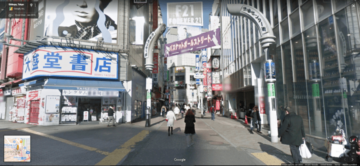
The car-free street begins at 5:47 (5 minutes 47 seconds into the video). This screenshot shows the entrance to Shibuya Center Street (see Note 1), coming from Tsutaya/Starbucks:

Here is the entrance in daytime (click to open Google StreetView in new tab):
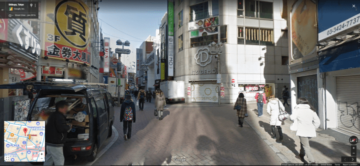
Center Street, one block NW from Tsutaya/Starbucks entrance :

And in daytime (click image to open Google StreetView in new tab):
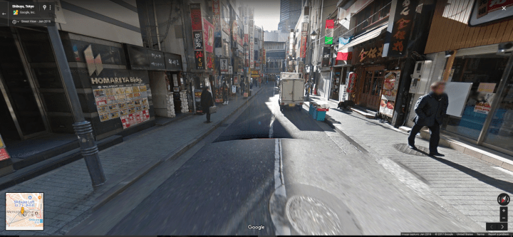
20 seconds farther down Center Street:

In daytime (click image for Google StreetView):


27 seconds farther down Center Street:

Same location in daytime (click image for StreetView):

25 seconds farther down Center Street:

(click here for daytime view in Google StreetView)
23 seconds farther down Center Street:

And again in daytime (click image for StreetView):


Rambalac takes a left here at McDonald’s, but Center Street continues on (total length is 350 meters ~ 1,150 feet). To see more of this street (and Inokashira Dori), please watch this walk-through video by Nippon Wandering, which also includes Nonbei Yokocho (see Note 2).
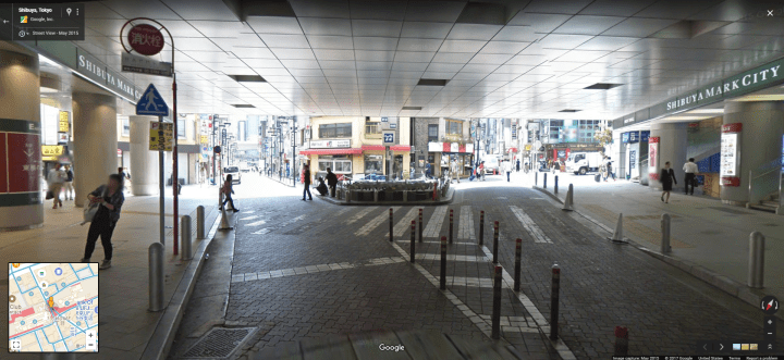
Another car-free street begins at 15:46 (at Lotteria):

And here in daytime (click image for StreetView):
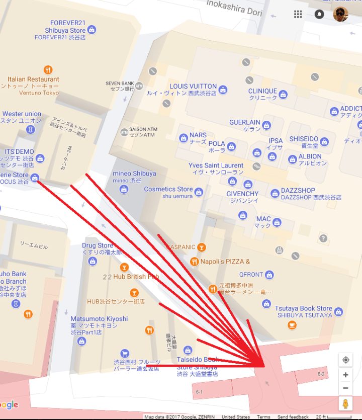
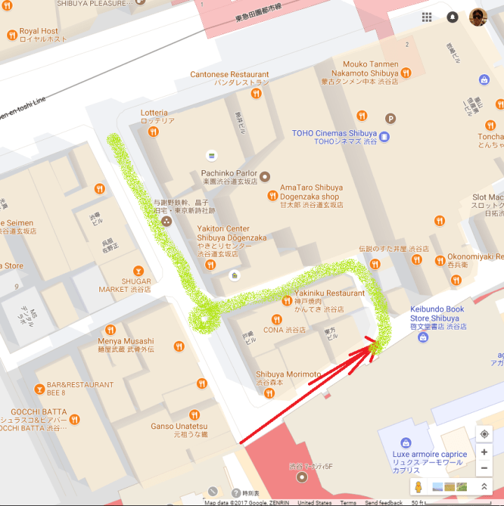
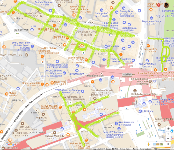
In the map below, blue highlights Rambalac’s route from 5:47 to 15:46, with the car-free portion double highlighted in green:

After walking towards Mark City for 31 seconds, Rambalac turns left at Ministop:
The view in daytime (click image for StreetView):

Emerging from a bent alley next to Keio Shibuya Station:

Fairly bland in daytime (click image for StreetView):

Rambalac’s path from 15:46 to 17:03:
Walking under the Keio Inokashira line tracks:


Daytime (click image for StreetView):
Taking a left and walking alongside Keio Shibuya Station / Mark City:


Daytime (click image for StreetView):

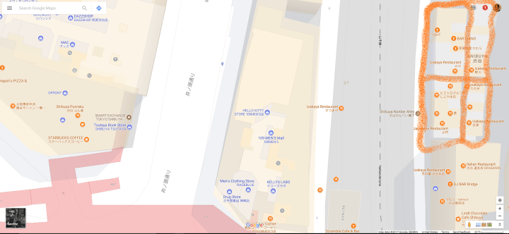
Nonbei Yokocho (~100 meters ~300 feet east of Tsutaya)
Screenshots from this walk-through video by Nippon Wandering:


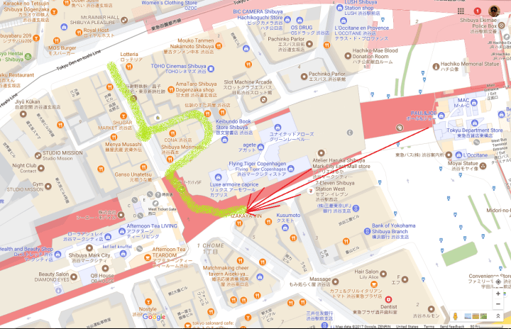
Finally, while there are certainly many more Hokoten and permanently pedestrianized streets in the area, here is an approximate map of the ones shown/visible in the two walk-through videos [correction: Inokashira Dori, though highlighted in green, is not Hokoten-ized; it has a single one-way lane, which continues to carry buses and taxis thru the evening]:
.
Note 1: “Shibuya Center Street” is actually a district comprised of two parallel streets and several connecting streets. These two parallel streets are shown on Google Maps as “Shibuya Center Gai” and “Inokashira Dori”. According to Wikipedia, “Shibuya Center Street” also includes Bunkamura Dori (not pedestrianized), Udagawa Dori, and Spanish Hill (car-free).
