Like Kyoto, Nara was modeled on Chinese capitals, and thus has a relatively more grid-like layout than most Japanese cities. In the aerial view below, the streets of central Nara are highlighted hierarchically as follows:
– Magenta: Arcades and open air, car-free shopping streets.
Magenta Outline: Stations (left end: elevated JR Nara, top: subway Kintetsu Nara).
– Cyan: SLOW street (Sanjo Dori).
– Red: “Busy” Boulevards.
– Orange: “Quiet” Boulevards.
– Yellow: Woonerfs & Narrow Streets.
– Green: Residential (and temple) laneways. Only a fraction (2/3?) are highlighted.

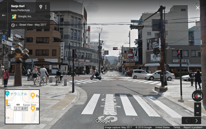
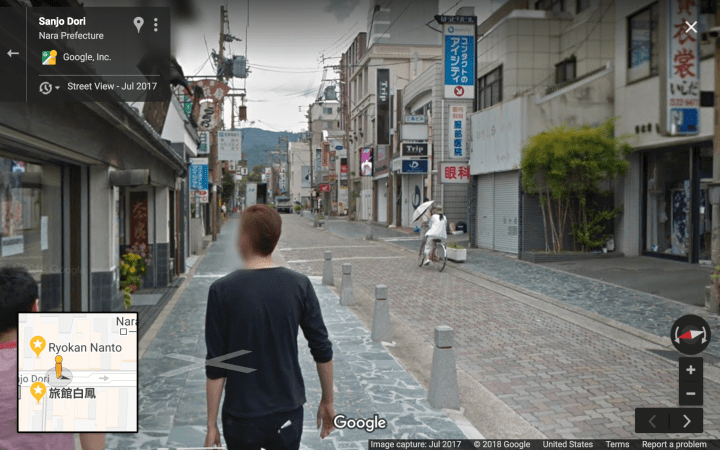
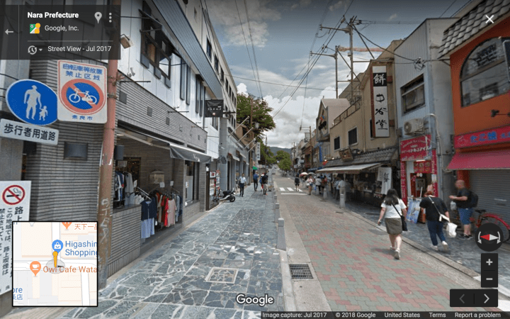
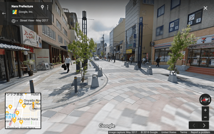
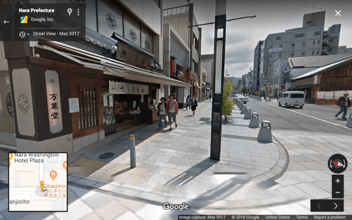
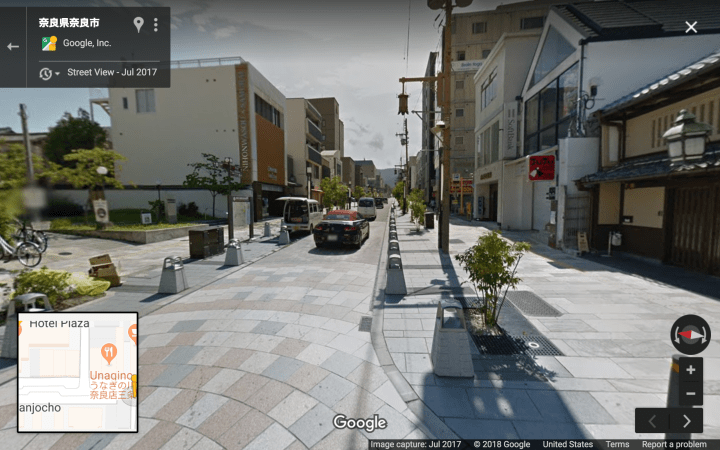
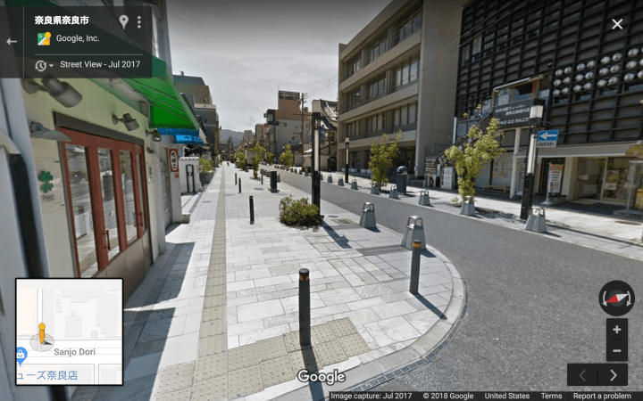
The cyan / light-blue street is Nara Sanjo-Dori, a Single Lane One Way street.
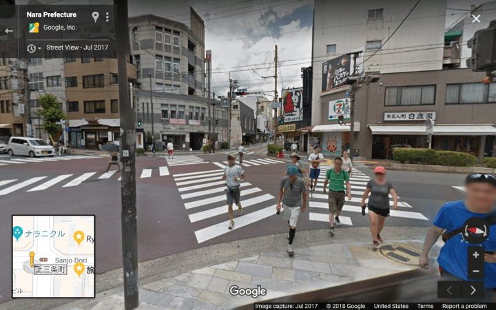
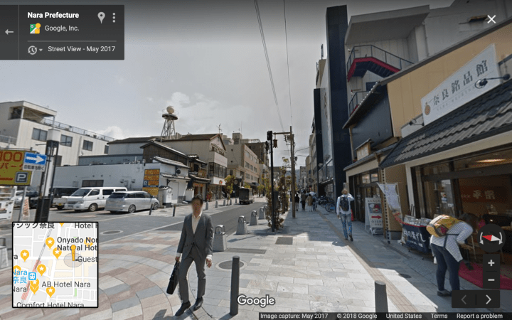
Note that the whole highlighted area lies within a single island of walkability (Sanjo-Dori bridges the busy north-south road with a safe & comfortable scramble intersection).
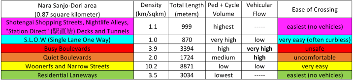
The Hierarchy of Japanese Streets categorizes the highlighted streets as follows* (with stats given for this area of Nara specifically):
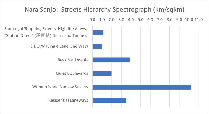
Measuring the length of each type of street* allows the whole map to be summarized with a “streets hierarchy spectograph”:
* Only a fraction (2/3?) of the Laneways are counted and highlighted (green).
By length, the dominant typology is Level 2 on the hierarchy (“Woonerfs and Narrow Streets: slow and very narrow streets where people and cars mix or are separated by a painted line”).
In terms of where the shops and people are to be found, Levels 6 and 5 (Shotengai etc. & SLOW streets) are overwhelmingly dominant.
PHOTO TOUR
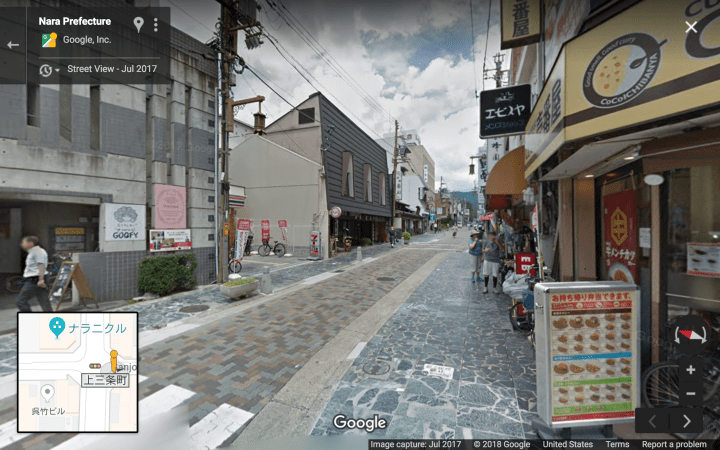
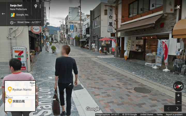
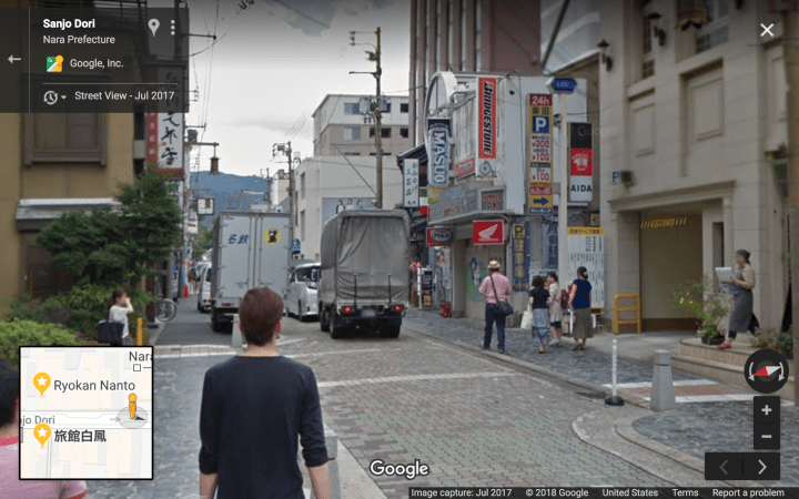
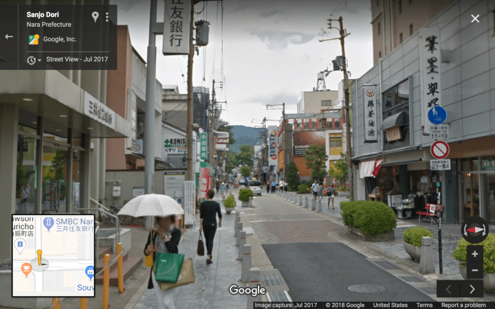
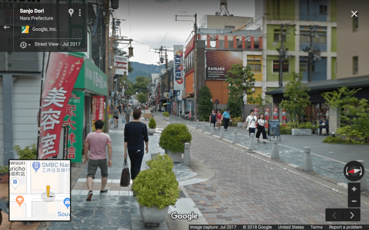
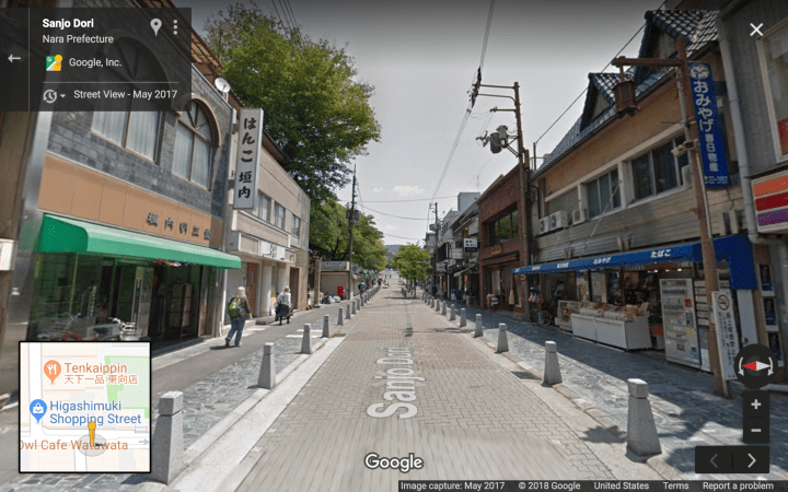
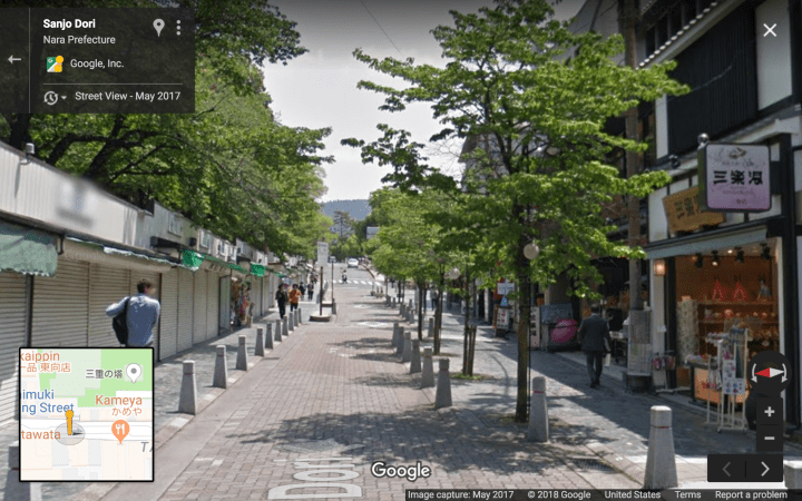
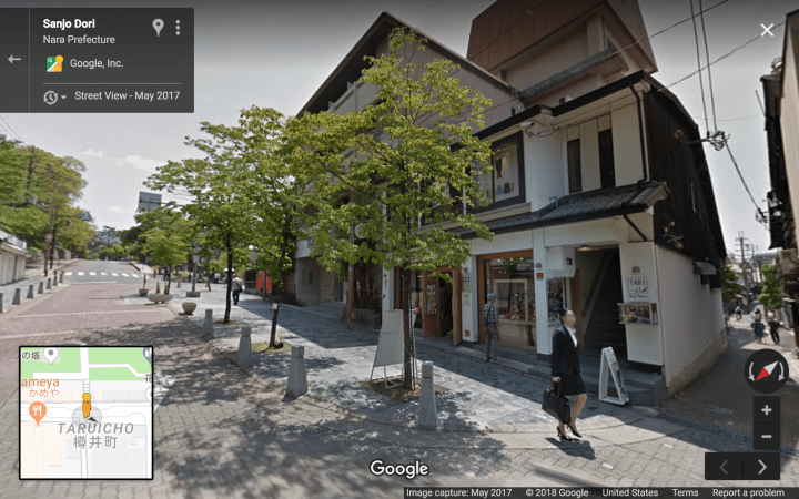
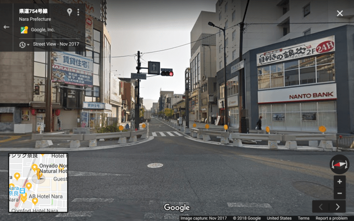
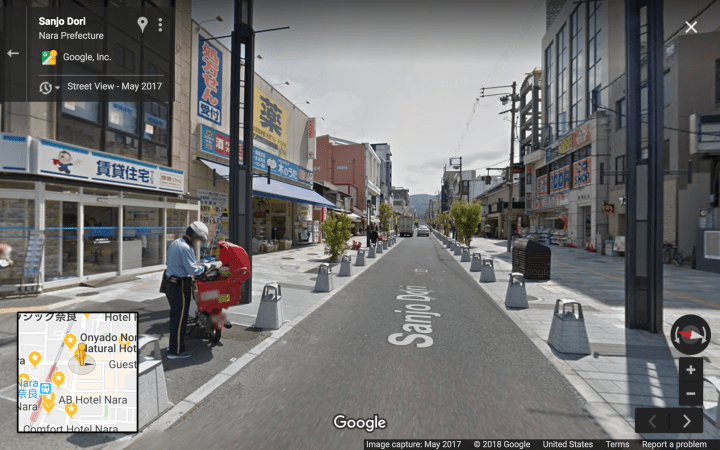
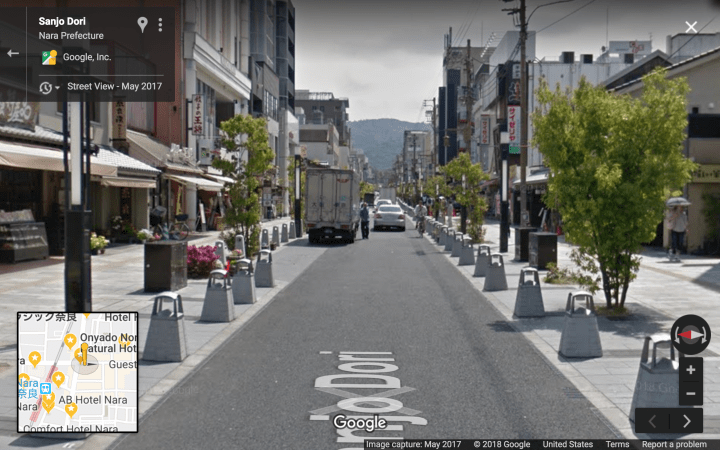
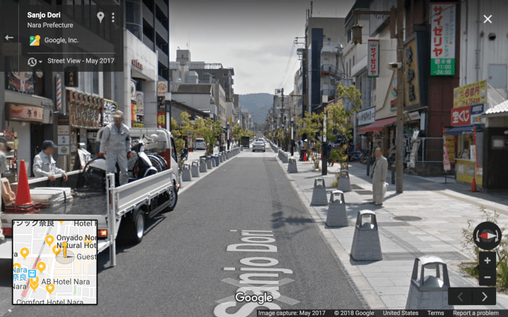
Keep an eye out for these key S.L.O.W. features:
– Absence of parking lanes.
– Frequently spaced trees and/or stone bollards.
– Curbless #SuperFlat facade-to-facade pavement.
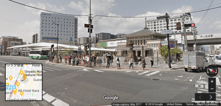
JR Nara Station (with historical station in front) as seen from the west end of the S.L.O.W. portion of Sanjo-Dori. Note the enormous roofed bus concourse:
Proceeding eastwards from JR Nara:
The scramble intersection (car phase and ped phase, respectively):