Hankyu Juso Station (阪急十三駅), just 3 minutes from Umeda, is a commercial node with covered shopping arcades extending directly from both west and east exit. This post will focus on the west side of the station.
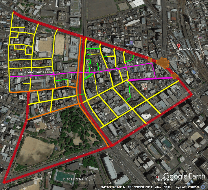
The streets above are highlighted hierarchically as follows:
– Magenta: Arcades and open air, car-free “nightlife alleys”.
– Red: “Busy” Boulevards.
– Orange: “Quiet” Boulevards.
Orange with Orange Outline: Scramble intersection and wide crosswalks.
– Yellow: Woonerfs & Narrow Streets.
– Green: Laneways. Only a fraction (3/4?) are highlighted.
Note that the whole highlighted area lies within a single island of walkability (the Friendly Street + Motoima Road arcade connects the two halves under the north-south elevated expressway).
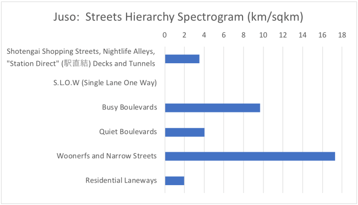
The Hierarchy of Japanese Streets categorizes the highlighted streets as follows* (with stats given for this area specifically):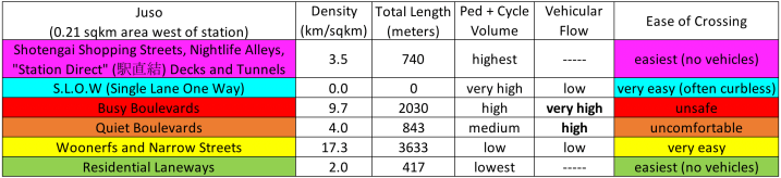
* Only a fraction (3/4?) of the Laneways are counted and highlighted (green).
Street Hierarchy, Illustrated
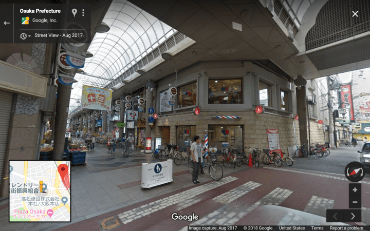
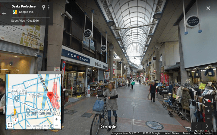
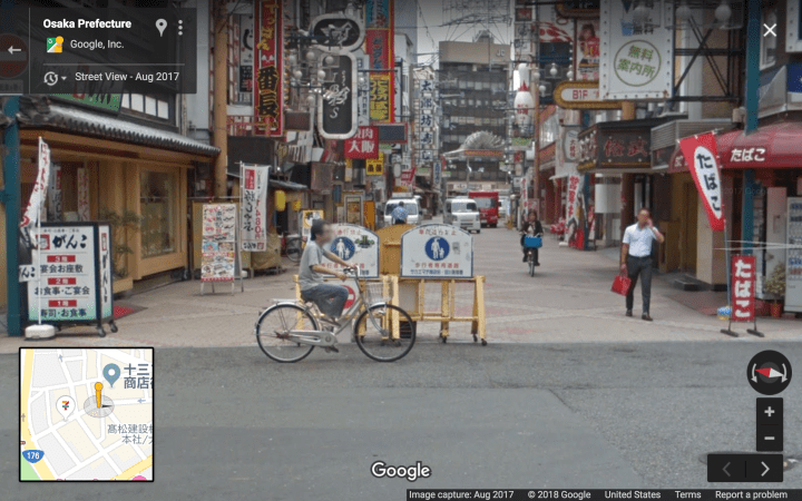
Level 6A, Covered Shopping Arcade:
Level 6B, Nightlife Alley (an unusually wide one):
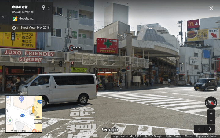
Level 4, Busy Boulevards:

Level 4, Busy Boulevard at scramble intersection:
Level 3, Quiet Boulevards:
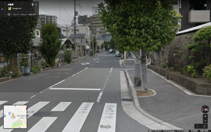

Level 2, Woonerfs and Narrow Streets:

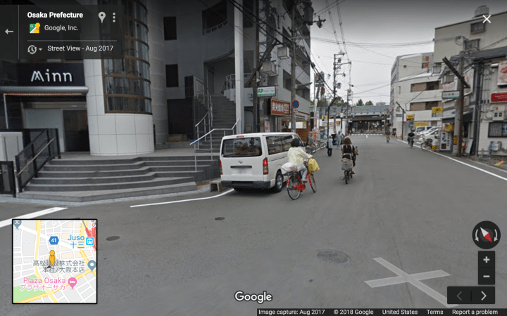
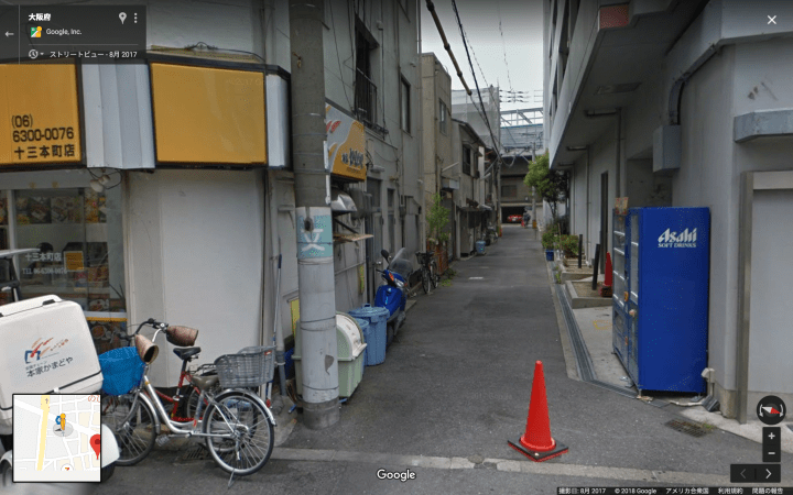
Level 1, Laneways:
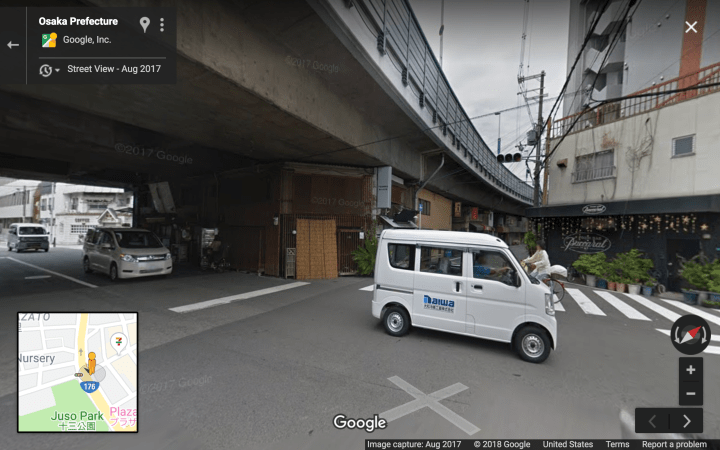
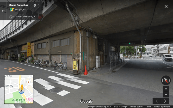
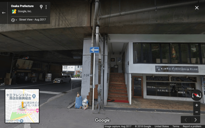
And finally, four views of a single highway underpass:
[ most elevated tracks & highways in Japan rank zero on the hierarchy, because they are high and narrow enough to not negatively impact the pedestrian experience. This highway is wide and low enough that it does create a bit of a division thru the city. Shops underneath go a long way to mitigate safety concerns. ]