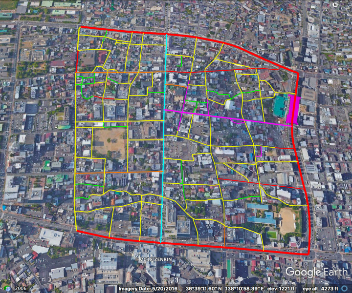
The streets above are highlighted hierarchically as follows:
– Magenta: Covered arcades and open-air shopping streets (de-facto car free).
– Magenta block on right side: Gondo subway station (長野電鉄・権堂駅). The large building on the west side is a station-direct-linked (駅直結) supermarket & department store.
– Cyan: Quasi-SLOW street.
– Red: “Busy” Boulevards.
– Orange: “Quiet” Boulevards.
– Yellow: Woonerfs & Narrow Streets.
– Green: Laneways. Only a fraction (1/2?) are highlighted.
Note that the highlighted area lies within a single island of walkability.
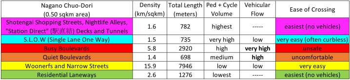
The Hierarchy of Japanese Streets categorizes the highlighted streets as follows* (with stats given for this area specifically):
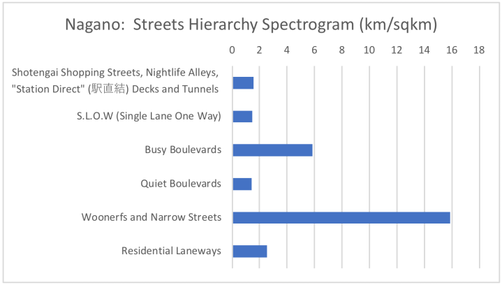
* NOTES:
1) Only a fraction (1/2?) of the Laneways are counted and highlighted (green).
2) The “Quiet Boulevards” here mostly lack bollards and street trees.
3) Some of the streets classified here as “Busy Boulevards” lack physically protected sidewalks. They are coded in red because they prioritize vehicular traffic (by allowing unfriendly vehicle speeds, or by enveloping the pedestrian space with parking). Thus they are in some sense worse than the regular “Busy Boulevard”, because they are unpleasant to walk along (not just unpleasant to cross).
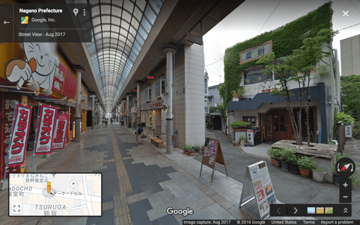
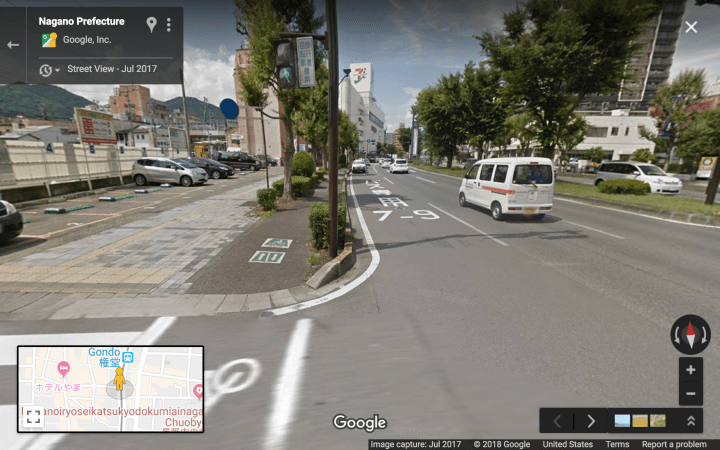
Streets Hierarchy, Illustrated
Level 6, covered arcades and open-air shopping streets:
Level 5, quasi SLOW street:

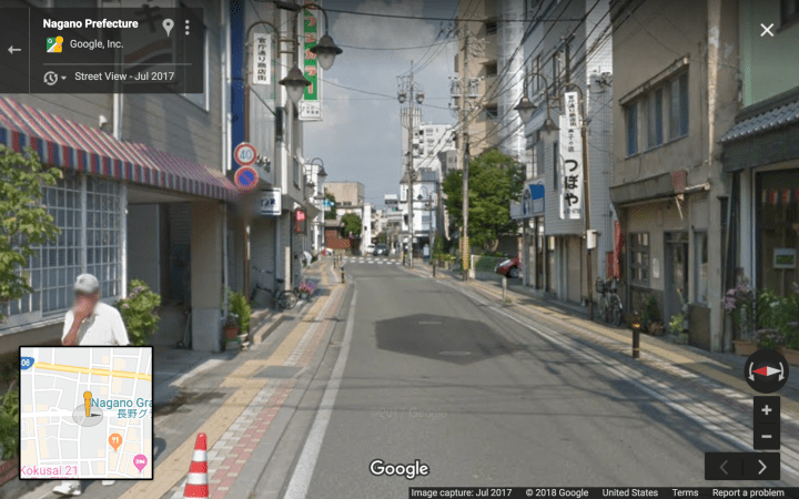
Level 4, “Busy Boulevard”:
Quasi-Level 4, quasi “Busy Boulevard” (lacks physically protected sidewalks):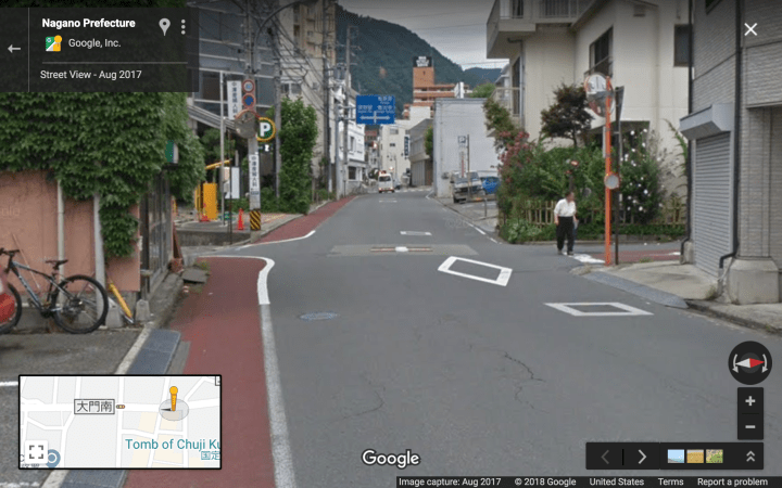
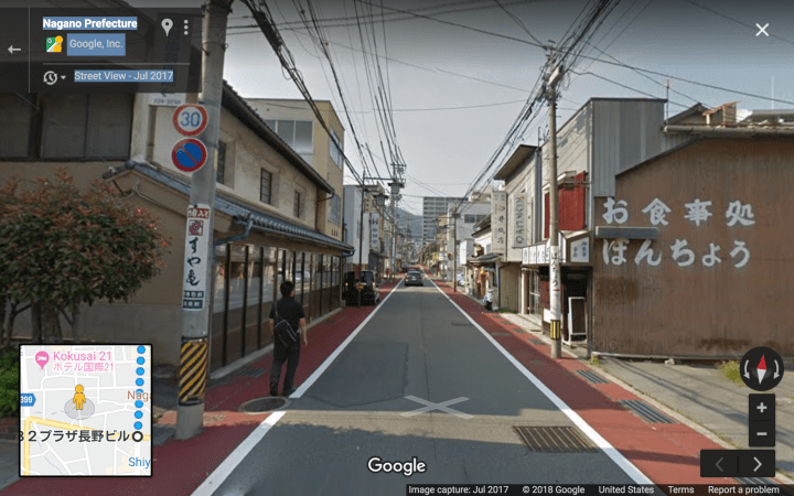
Level 3, “Quiet Boulevard”:
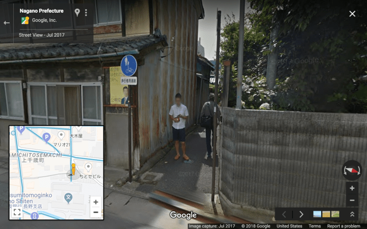
Level 2, Woonerfs and Narrow Streets:
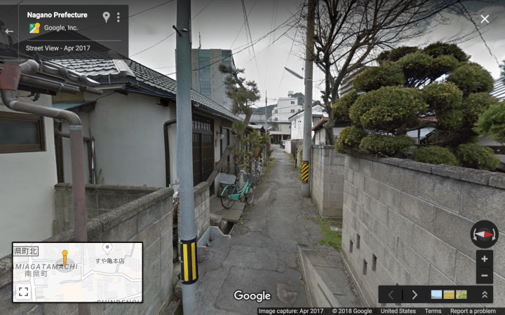
Level 1, Residential Laneways: