

Map from feel-kobe.jp [red marker added]
Analysis of the area SE of Sannomiya Stations; Onoedori (小野柄通), Gokodori (御幸通), Isogamidori (磯上通), Isobedori (磯辺通), and Hamabedori (浜辺通).
The area has a bit of a de-industrialised feel, consistent with its much shrunken population (a dramatic decline between 1920 and 1960; a considerable recovery between 1988 and 2005). Isogamidori is representative of these two demographic shifts, visible in all the administrative chou (町) in this area.
The total residential population in the 2005 census was about 3,100.
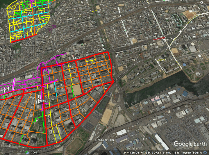
Above: the highlighted area in the top-left is the Kitano Ijinkan area. The highlighted area in the bottom-left is the Foreign Settlement. The Isogami Park area, east of the Foreign Settlement, is shown below.
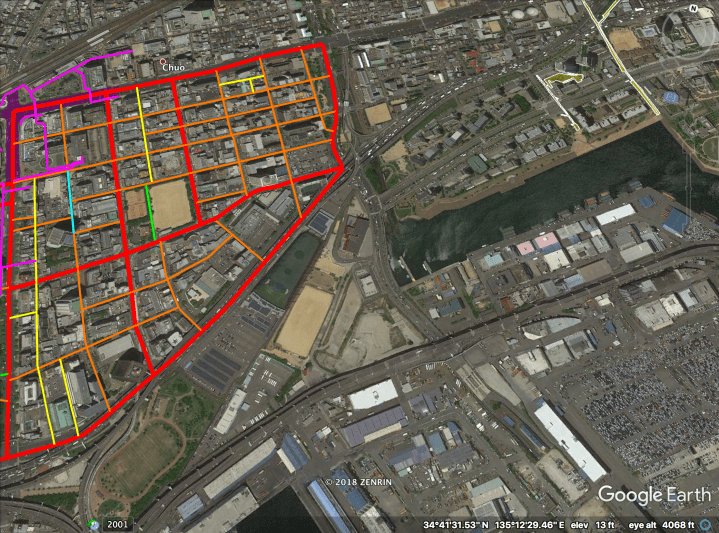 Streets are highlighted hierarchically as follows:
– Magenta (NW corner, north side): Station Direct Linked Deck Level.
– Magenta (NW corner, west side): Station Direct Linked tunnels.
– Cyan: Fukiai-Minami (Route 54) SLOW street.
– Red: “Busy” Boulevards.
– Orange: “Quiet” Boulevards [in this area, most lack bollards].
– Yellow: Woonerfs & Narrow Streets.
– Green: Park Laneway.
*** Outside of Isogami Park area: ***
– Purple block (NW corner): Station Direct Linked underground shopping mall “Santika”.
– Magenta: Station Direct Linked tunnels and Deck Level.
– Yellow blocks with white outline: Kobe High Line and pedestrian overpasses in “Healthy Active Town”.
Note that “Busy” Boulevards divide the area into five roughly equal sized islands of walkability.
The Hierarchy of Japanese Streets categorizes the highlighted streets as follows (with stats given for this area specifically):
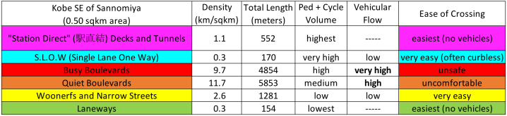

* In contrast to the archetype, most “Quiet” Boulevards in this area lack bollards.
Streets Hierarchy, Illustrated
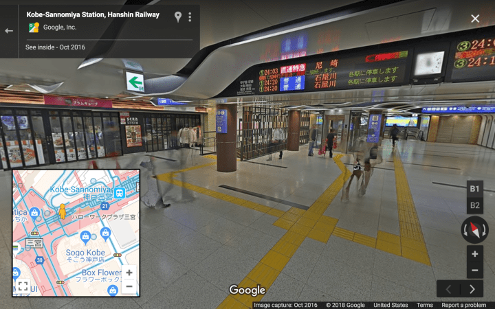
Level 6C, station direct linked Deck Level:

Level 6D, station direct linked tunnels:
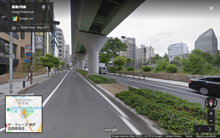
Level 5, SLOW street:
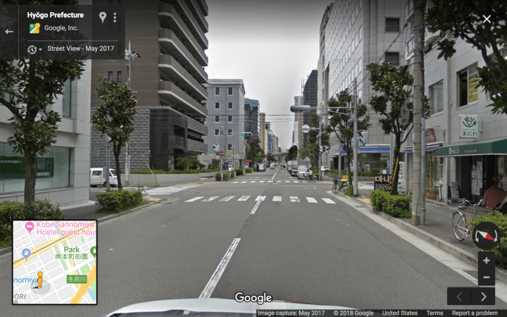
Level 4, “Busy” Boulevards:

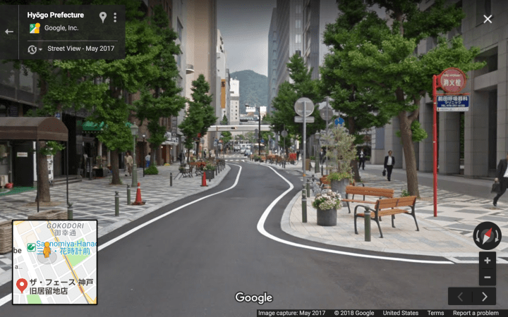
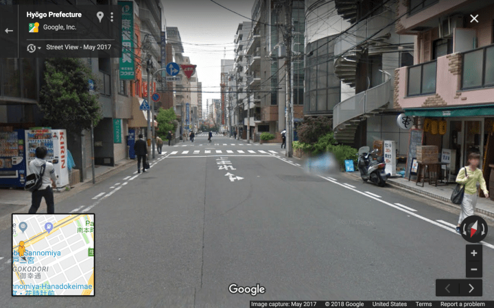
Level 3, “Quiet” Boulevards:
[in contrast to the archetype, most “Quiet” Boulevards here lack bollards]

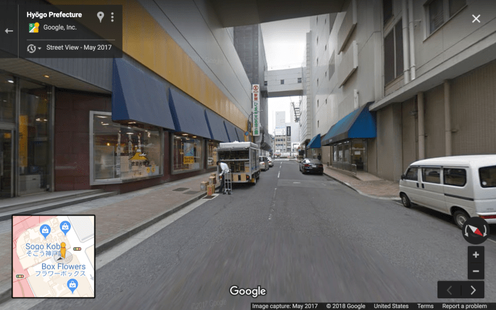

Level 2, Woonerfs and Narrow Streets:
Level 1, Car-free paths [not pictured].
